

Brewer Lake Trail


Difficulty Rating: Easiest
For beginners and people testing out new vehicles. Brewer Lake is 3.5 miles; 1 hour driving time.
Directions to Route:
-
Take Hwy 168 east from the town of Shaver Lake and turn into the Tamarack Snow Park.
-
Take Road 9SO9 approximately 3 miles, then turn left on Road 9S69.
-
Continue on Road 9S69 for 2 miles until you reach Road 9S10 on your right.
-
Follow Road 9S10 for 1.5 miles.
-
Looking to your left, across the large sandy ridgetop, you will see the gate and bulletin boards designating the start of the Brewer off-highway vehicle route.
The Route:
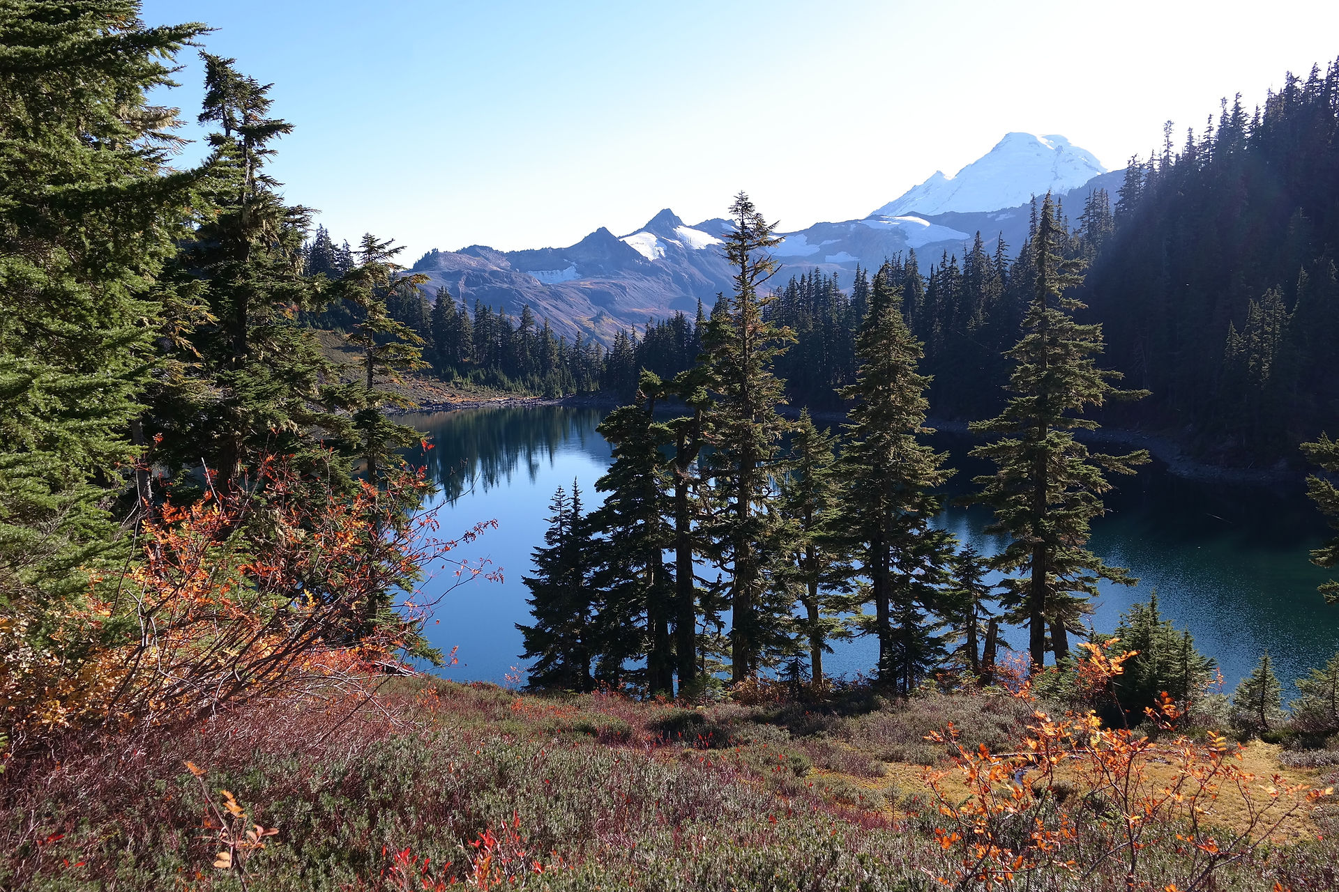
This route follows Foster Ridge, the dividing line between the old Kings River and Pineridge Ranger Districts. The ridge also separates water flowing north to the San Joaquin River and south to the Kings River. As you drive, notice the many gradual changes and variations in the surrounding environment. Flora and fauna are influenced by the amount of moisture, soils, topography, and exposure to the afternoon sun. You will find the moister areas heavily forested and a haven for wildflowers and feeding deer, while open, drier spaces are comparatively barren. The dominant trees here are red fir, which are usually dense on north?facing slopes, and lodgepole pine, which grows in pure stands around water bodies and meadows.
The route gradually gains elevation for the first mile going through red fir groves and a series of cool, moist areas. It then joins the crest of the ridge for the remaining 2.5 miles. As the route joins the crest, it enters an open, hot and dry area where only hardiest vegetation can survive.
Less than a half mile from the lake you will encounter "the rockpile". This steep and rocky section winds up and around a large rockpile. This is the largest obstacle along this route. In most cases, a slow, steady, direct approach will get you through just fine. As you approach Brewer Lake, the route drops off the ridge and stops short of the lakeshore. The lakeshore is thickly forested along with many large boulders scattered about. Vehicle access to the limited campsites closer to the lake is difficult. Other ideal campsites can be found along the route, about 50 yards before the trail ends. The many dispersed campsites offer a grand view of Brewer Lake and easy access to good fishing.
The trip to Brewer Lake can easily be made in one day from Dinkey Creek, Shaver Lake, or even Fresno. Instead of making a quick trip, take the time to fish the far shore of the lake or test the waters at nearby Tocher and Beryl Lakes, a short distance away by foot trail. If the fish are not biting there, you can try fishing the outlet streams and the upper reaches of Tamarack Creek. Even if you don't catch the "big one", you'll see some nice country and experience wilderness like solitude.
CAMPSITES ALONG ROUTE (DRIVING TIMES):
-
Brewer Lake (3.1 miles 1 hour)
Camping tips:
There is no camping within 100 feet from lakes, streams, trails and meadows. Campfire permits are free and available at your local Forest Service office. A campfire permit is required for: wood fires, charcoal fires or portable gas stoves.
If you pack it in, please pack it out. Keep your forest clean and green.